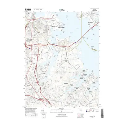
2016 Map of Curtis Bay
USGS Topo · Published 2016About this map
Industrial waterfronts and suburban expansion characterize this coastal corridor south of the city, where the Patapsco River meets the Chesapeake Bay. The map documents a dense network of neighborhoods such as Brooklyn, Harundale, and Pasadena, interspersed with historical burial grounds including Cedar Hill Cem and Holy Cross Cem. The presence of the B & O RR and the Harbor Tunnel illustrates the region's importance as a transportation hub, while numerous coves like Tanyard Cove and Nabbs Creek provide access to the water for communities like Riviera Beach and Orchard Beach. Genealogists will find significant value in the detailed cemetery locations, such as the John Wesley United Methodist Church Cem, which anchor the local history of these communities. The transition from the industrial landscape near Wagners Point to the residential shorelines of Stony Beach and Mount Pleasant Beach highlights the diverse land use of this maritime region.
Find a feature on this map
304 named features on this map. Tap any name to fly to it.
Don’t see what you’re looking for? This feature index may not catch every label — zoom into the map to look around manually.
Map Details
Editions of this 2016 Curtis Bay Map
This is the sole edition of this map. No revisions or reprints were ever made.
Other maps of this area

1893 · North Point
USGS Topo · 1:62,500

1893 · Gunpowder
USGS Topo · 1:62,500

1894 · Baltimore
USGS Topo · 1:62,500

1894 · Relay
USGS Topo · 1:62,500

1898 · Tolchester
USGS Topo · 1:125,000

1899 · Baltimore
USGS Topo · 1:62,500

1901 · Gunpowder
USGS Topo · 1:62,500

1903 · Tolchester
USGS Topo · 1:125,000

1904 · Baltimore
USGS Topo · 1:62,500

1904 · North Point
USGS Topo · 1:62,500