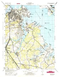
1944 Map of Curtis Bay
USGS Topo · Published 1944About this map
The industrial and maritime landscape of Curtis Bay and the Patapsco River shoreline dominate this 1944 War Department survey. Reflecting the era's mobilization, the map depicts significant federal installations including the U S Army Ordnance Depot, the U S Coast Guard base at Arundel Cove, and the U S Quarantine Station near Leading Point. Heavy rail infrastructure like the Baltimore and Ohio and Pennsylvania lines connect the shipping terminals at Wagners Point and East Brooklyn to the inland settlements of Brooklyn Park and Glen BurnIE.
Find a feature on this map
95 named features on this map. Tap any name to fly to it.
Don’t see what you’re looking for? This feature index may not catch every label — zoom into the map to look around manually.
Map Details
Editions of this 1944 Curtis Bay Map
This is the sole edition of this map. No revisions or reprints were ever made.
Other maps of this area

1893 · North Point
USGS Topo · 1:62,500

1893 · Gunpowder
USGS Topo · 1:62,500

1894 · Baltimore
USGS Topo · 1:62,500

1894 · Relay
USGS Topo · 1:62,500

1898 · Tolchester
USGS Topo · 1:125,000

1899 · Baltimore
USGS Topo · 1:62,500

1901 · Gunpowder
USGS Topo · 1:62,500

1903 · Tolchester
USGS Topo · 1:125,000

1904 · Baltimore
USGS Topo · 1:62,500

1904 · North Point
USGS Topo · 1:62,500