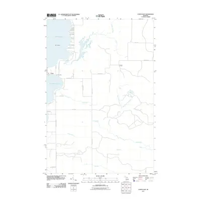
2011 Map of Curtis East
USGS Topo · Published 2011About this map
Manistique Lake and its smaller counterpart, South Manistique Lake, anchor this portion of Mackinac County, separated by a narrow land bridge that supports the settlement of Curtis. This area serves as a significant hydraulic junction where Portage Creek and Black Creek converge, eventually feeding into the larger lake system. The landscape is defined by its transition from open water to complex wetlands, illustrated by the intricate drainage of Furlong Creek and its branches, which collect in Furlong Pond before moving southeast toward Spot Lake.
Find a feature on this map
32 named features on this map. Tap any name to fly to it.
Don’t see what you’re looking for? This feature index may not catch every label — zoom into the map to look around manually.
Map Details
Editions of this 2011 Curtis East Map
This is the sole edition of this map. No revisions or reprints were ever made.
Other maps of this area

1931 · Gould City NE
USGS Topo · 1:31,680

1931 · Gould City NW
USGS Topo · 1:31,680

1931 · Seney SE
USGS Topo · 1:31,680

1931 · Blaney NE
USGS Topo · 1:31,680

1931 · Gould City SE
USGS Topo · 1:31,680

1931 · Blaney SE
USGS Topo · 1:31,680

1954 · Sault Sainte Marie
USGS Topo · 1:250,000

1956 · Sault Sainte Marie
USGS Topo · 1:250,000

1957 · Sault Sainte Marie
USGS Topo · 1:250,000

1958 · Sault Sainte Marie
USGS Topo · 1:250,000