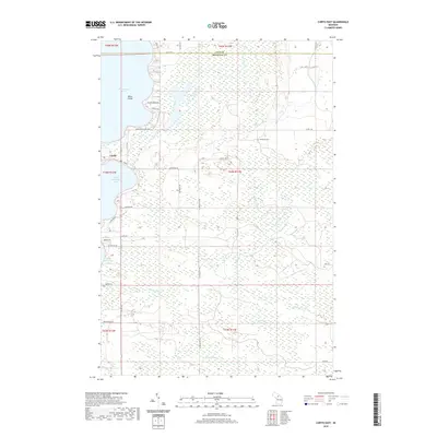
2019 Map of Curtis East
USGS Topo · Published 2019About this map
Manistique Lake and South Manistique Lake dominate this eastern Mackinac County landscape, connected by a narrow strip of land where the settlement of Curtis is situated. This area, largely defined by its extensive wetland networks and drainage systems, features the Sandtown Cem tucked away near the junction of Co RD 1140 and Sandtown RD. The topography is marked by a complex system of waterways including Black Creek, Portage Cr, and Strom Cr, which meander through the low-lying terrain toward the larger lakes.
Find a feature on this map
42 named features on this map. Tap any name to fly to it.
Don’t see what you’re looking for? This feature index may not catch every label — zoom into the map to look around manually.
Map Details
Editions of this 2019 Curtis East Map
This is the sole edition of this map. No revisions or reprints were ever made.
Other maps of this area

1931 · Gould City NE
USGS Topo · 1:31,680

1931 · Gould City NW
USGS Topo · 1:31,680

1931 · Seney SE
USGS Topo · 1:31,680

1931 · Blaney NE
USGS Topo · 1:31,680

1931 · Gould City SE
USGS Topo · 1:31,680

1931 · Blaney SE
USGS Topo · 1:31,680

1954 · Sault Sainte Marie
USGS Topo · 1:250,000

1956 · Sault Sainte Marie
USGS Topo · 1:250,000

1957 · Sault Sainte Marie
USGS Topo · 1:250,000

1958 · Sault Sainte Marie
USGS Topo · 1:250,000