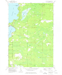
1973 Map of Curtis East
USGS Topo · Published 1977About this map
Manistique Lake and South Manistique Lake anchor this 1970s landscape on the boundary of Luce and Mackinac counties. The settlement of Curtis serves as a central hub between the lakes, while the surrounding terrain is dominated by the sprawling reaches of the Mackinac State Forest and Tahquamenon River State Forest. The map documents a transition from active industry to protected wilderness, evidenced by numerous Gravel Pits and the lingering path of the Old Railroad Grade cutting through the timberlands.
Find a feature on this map
33 named features on this map. Tap any name to fly to it.
Don’t see what you’re looking for? This feature index may not catch every label — zoom into the map to look around manually.
Map Details
Editions of this 1973 Curtis East Map
This is the sole edition of this map. No revisions or reprints were ever made.
Other maps of this area

1931 · Gould City NE
USGS Topo · 1:31,680

1931 · Gould City NW
USGS Topo · 1:31,680

1931 · Seney SE
USGS Topo · 1:31,680

1931 · Blaney NE
USGS Topo · 1:31,680

1931 · Gould City SE
USGS Topo · 1:31,680

1931 · Blaney SE
USGS Topo · 1:31,680

1954 · Sault Sainte Marie
USGS Topo · 1:250,000

1956 · Sault Sainte Marie
USGS Topo · 1:250,000

1957 · Sault Sainte Marie
USGS Topo · 1:250,000

1958 · Sault Sainte Marie
USGS Topo · 1:250,000