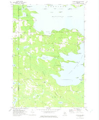
1972 Map of Curtis West
USGS Topo · Published 1975About this map
South Manistique Lake and Manistique Lake dominate this Upper Peninsula landscape, connected by a narrow land bridge that supports the settlement of Curtis. This 1970s survey captures a transition between timber extraction and recreational development, where an Old Railroad Grade and numerous Gravel Pits coexist with the South Manistique Lake Campground and various Public Access points. The map meticulously documents the network of local transport, including Ketola Road and Mc Gahn Road, providing a clear view of the area's rural structure. Local history is anchored by the Curtis Cem and Sandpit Cem, while the surrounding terrain is heavily defined by the Mackinac State Forest and Lakefield State Forest. Prominent water features like Shoepac Lake, Wolf Creek, and Cooks Bay detail the complex hydrology between Mackinac, Luce, and Schoolcraft counties.
Find a feature on this map
48 named features on this map. Tap any name to fly to it.
Don’t see what you’re looking for? This feature index may not catch every label — zoom into the map to look around manually.
Map Details
Editions of this 1972 Curtis West Map
This is the sole edition of this map. No revisions or reprints were ever made.
Other maps of this area

1931 · Seney SW
USGS Topo · 1:31,680

1931 · Gould City NW
USGS Topo · 1:31,680

1931 · Blaney SW
USGS Topo · 1:31,680

1931 · Seney SE
USGS Topo · 1:31,680

1931 · Blaney NE
USGS Topo · 1:31,680

1931 · Blaney SE
USGS Topo · 1:31,680

1931 · Blaney NW
USGS Topo · 1:31,680

1954 · Sault Sainte Marie
USGS Topo · 1:250,000

1956 · Sault Sainte Marie
USGS Topo · 1:250,000

1957 · Sault Sainte Marie
USGS Topo · 1:250,000
Featured Places
- Newton Township, MI
- Portage Township, MI
- Lakefield Township, MI
- Germfask Township, MI
- Mueller Township, MI