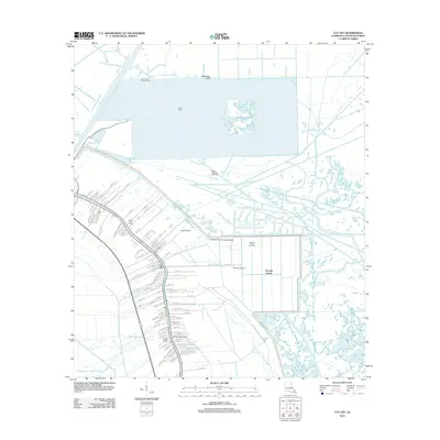
2012 Map of Cut Off
USGS Topo · Published 2012About this map
Bayou Lafourche anchors the settlement of Cut Off in this 2012 survey of the southern Louisiana coastal landscape. The region's intricate relationship with water and industry is evident in the dense network of waterways like the Scully Canal and Raccoon Bayou that cut through the low-lying marshes. The local economy and transportation infrastructure are defined by a mix of traditional agriculture at Clovelly Farms and Delta Farms, alongside modern energy production in the Larose Oil and Gas Field and Bayou Poignard Gas Field.
Find a feature on this map
114 named features on this map. Tap any name to fly to it.
Don’t see what you’re looking for? This feature index may not catch every label — zoom into the map to look around manually.
Map Details
Editions of this 2012 Cut Off Map
This is the sole edition of this map. No revisions or reprints were ever made.
Other maps of this area

1892 · Barataria
USGS Topo · 1:62,500

1892 · Cut-Off
USGS Topo · 1:62,500

1892 · Creole
USGS Topo · 1:62,500

1894 · Lake Felicity
USGS Topo · 1:62,500

1935 · Viguerie Canal
USGS Topo · 1:31,680

1935 · Golden Meadow
USGS Topo · 1:31,680

1939 · Cut-Off
USGS Topo · 1:62,500

1939 · Lake Felicity
USGS Topo · 1:62,500

1941 · Cut-Off
USGS Topo · 1:62,500

1941 · Lake Felicity
USGS Topo · 1:62,500