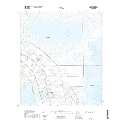
2018 Map of Cut Off
USGS Topo · Published 2018About this map
Bayou Lafourche serves as the primary axis of development for this coastal Louisiana landscape, where settlement patterns are dictated by the narrow ribbons of high ground bordering the water. In the community of Cut Off, dense residential streets like W 17th St and Providence Ave cluster along the bayou banks, connected by the Cote Blanche Bridge. Moving away from the waterway, the terrain quickly gives way to the extensive marshlands of Clovelly Farms and the intricate hydrology of the Mississippi Delta, defined by the Intracoastal Waterway and numerous natural channels including Bayou Poignard and Bayou de la Gauche. Local history is anchored by sites like the Sacred Heart Cem / Mausoleum and New Mount Zion Baptist Cem, reflecting the cultural and genealogical foundations of this Lafourche Parish region.
Find a feature on this map
81 named features on this map. Tap any name to fly to it.
Don’t see what you’re looking for? This feature index may not catch every label — zoom into the map to look around manually.
Map Details
Editions of this 2018 Cut Off Map
This is the sole edition of this map. No revisions or reprints were ever made.
Other maps of this area

1892 · Barataria
USGS Topo · 1:62,500

1892 · Cut-Off
USGS Topo · 1:62,500

1892 · Creole
USGS Topo · 1:62,500

1894 · Lake Felicity
USGS Topo · 1:62,500

1935 · Viguerie Canal
USGS Topo · 1:31,680

1935 · Golden Meadow
USGS Topo · 1:31,680

1939 · Cut-Off
USGS Topo · 1:62,500

1939 · Lake Felicity
USGS Topo · 1:62,500

1941 · Cut-Off
USGS Topo · 1:62,500

1941 · Lake Felicity
USGS Topo · 1:62,500