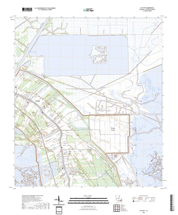
2024 Map of Cut Off
USGS Topo · Published 2024About this map
Bayou Lafourche serves as the central spine for this coastal Louisiana landscape, where the linear settlements of Larose and Cut Off parallel the water's edge. This pattern reflects the traditional "long lot" land division common in the region, providing residents with critical water access. The northern portion of the map is dominated by the Intracoastal Waterway, a vital engineering feat for maritime transport that cuts through the low-lying wetlands.
Find a feature on this map
81 named features on this map. Tap any name to fly to it.
Don’t see what you’re looking for? This feature index may not catch every label — zoom into the map to look around manually.
Map Details
Editions of this 2024 Cut Off Map
This is the sole edition of this map. No revisions or reprints were ever made.
Other maps of this area

1892 · Barataria
USGS Topo · 1:62,500

1892 · Cut-Off
USGS Topo · 1:62,500

1892 · Creole
USGS Topo · 1:62,500

1894 · Lake Felicity
USGS Topo · 1:62,500

1935 · Viguerie Canal
USGS Topo · 1:31,680

1935 · Golden Meadow
USGS Topo · 1:31,680

1939 · Cut-Off
USGS Topo · 1:62,500

1939 · Lake Felicity
USGS Topo · 1:62,500

1941 · Cut-Off
USGS Topo · 1:62,500

1941 · Lake Felicity
USGS Topo · 1:62,500