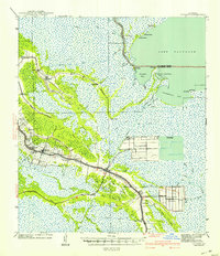
1941 Map of Cut-Off
USGS Topo · Published 1941About this map
Bayou Des Allemands flows into the expansive Lake Salvador at the northern edge of this Lafourche Parish survey. The landscape is a intricate network of waterways, including the Company Canal and Harvey Canal No. 2, which supported the region's agricultural and maritime activities before the mid-century. Large-scale operations such as Delta Farms and Clovelly Farms occupy the lowlands, while small ribbon settlements like Larose and Cut-Off line the banks of the bayous. Local education and faith are anchored by numerous neighborhood landmarks, including Griffin Ch and Vacherie Sch. The southern portion of the quadrangle shows the early layout of the Intracoastal Waterway, illustrating the critical role of canal-based transit in this wetland environment.
Find a feature on this map
70 named features on this map. Tap any name to fly to it.
Don’t see what you’re looking for? This feature index may not catch every label — zoom into the map to look around manually.
Map Details
Editions of this 1941 Cut-Off Map
2 editions found

Other maps of this area

1891 · Hahnville
USGS Topo · 1:62,500

1891 · New Orleans
USGS Topo · 1:62,500

1892 · Barataria
USGS Topo · 1:62,500

1892 · Lac Des Allemands
USGS Topo · 1:62,500

1892 · Cut-Off
USGS Topo · 1:62,500

1892 · Houma
USGS Topo · 1:62,500

1892 · Creole
USGS Topo · 1:62,500

1894 · Lake Felicity
USGS Topo · 1:62,500

1894 · Dulac
USGS Topo · 1:62,500

1932 · Houma SE
USGS Topo · 1:31,680