
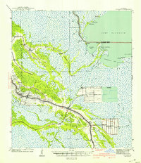
1941 Map of Cut-Off
USGS Topo · Published 1941About this map
Bayou Lafourche serves as the central artery for this coastal landscape, where narrow strips of settlement like Larose and Cut-Off follow the river's high ground before giving way to the surrounding marsh. The map captures a moment of significant agricultural and industrial modification in the wetlands, most notably at Delta Farms and Clovelly Farms, where extensive canal systems and reclaimed land projects are clearly documented. These agrarian developments are contrasted by the natural expanses of Lake Salvador and Catahoula Bay to the east.
Find a feature on this map
66 named features on this map. Tap any name to fly to it.
Don’t see what you’re looking for? This feature index may not catch every label — zoom into the map to look around manually.
Map Details
Editions of this 1941 Cut-Off Map
2 editions found
Other maps of this area

1891 · Hahnville
USGS Topo · 1:62,500

1891 · New Orleans
USGS Topo · 1:62,500

1892 · Barataria
USGS Topo · 1:62,500

1892 · Lac Des Allemands
USGS Topo · 1:62,500

1892 · Cut-Off
USGS Topo · 1:62,500

1892 · Houma
USGS Topo · 1:62,500

1892 · Creole
USGS Topo · 1:62,500

1894 · Lake Felicity
USGS Topo · 1:62,500

1894 · Dulac
USGS Topo · 1:62,500

1932 · Houma SE
USGS Topo · 1:31,680