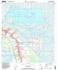
1998 Map of Cut Off
USGS Topo · Published 2001About this map
Bayou Lafourche serves as the central artery for this late 20th-century landscape, where the long-lot patterns of historical French Acadian settlement meet modern industrial expansion. The ribbon development along the bayou connects the communities of Larose and Cut Off, featuring essential local landmarks like Mt Zion Sch and Cut Off Sch. This period shows the transition of traditional agricultural tracts into large-scale operations like Clovelly Farms and the extensive Delta Farms, which are flanked by evidence of the region's energy economy.
Find a feature on this map
31 named features on this map. Tap any name to fly to it.
Don’t see what you’re looking for? This feature index may not catch every label — zoom into the map to look around manually.
Map Details
Editions of this 1998 Cut Off Map
This is the sole edition of this map. No revisions or reprints were ever made.
Other maps of this area

1892 · Barataria
USGS Topo · 1:62,500

1892 · Cut-Off
USGS Topo · 1:62,500

1892 · Creole
USGS Topo · 1:62,500

1894 · Lake Felicity
USGS Topo · 1:62,500

1935 · Viguerie Canal
USGS Topo · 1:31,680

1935 · Golden Meadow
USGS Topo · 1:31,680

1939 · Cut-Off
USGS Topo · 1:62,500

1939 · Lake Felicity
USGS Topo · 1:62,500

1941 · Cut-Off
USGS Topo · 1:62,500

1941 · Lake Felicity
USGS Topo · 1:62,500