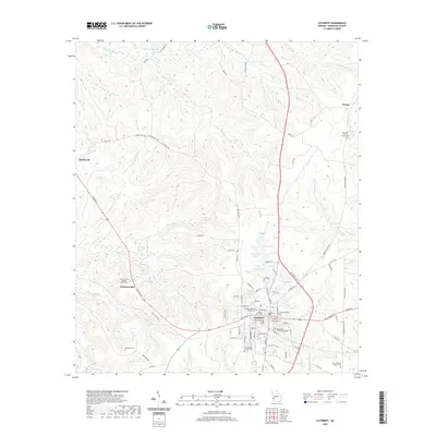
2020 Map of Cuthbert
USGS Topo · Published 2020About this map
Cuthbert serves as the focal point of this Randolph County landscape, anchored by the historic Andrew College campus and the central Randolph County Courthouse. The town’s street grid transitions into a network of country roads like Benevelence Hwy and Old Springvale Rd, connecting outlying settlements such as Springvale and Wades. The terrain is defined by a dense drainage system of creeks and branches, including Pachitla Cr and Holanna Cr, which carve through the elevations around Peterson Hill.
Find a feature on this map
102 named features on this map. Tap any name to fly to it.
Don’t see what you’re looking for? This feature index may not catch every label — zoom into the map to look around manually.
Map Details
Editions of this 2020 Cuthbert Map
This is the sole edition of this map. No revisions or reprints were ever made.
Other maps of this area

1953 · Dothan
USGS Topo · 1:250,000

1954 · Dothan
USGS Topo · 1:250,000

1955 · Dothan
USGS Topo · 1:250,000
1972 · Sanford
USGS Topo · 1:24,000
1972 · Benevolence
USGS Topo · 1:24,000
1972 · County Line
USGS Topo · 1:24,000
1972 · Brooksville
USGS Topo · 1:24,000
1972 · Cuthbert
USGS Topo · 1:24,000
1973 · Morris
USGS Topo · 1:24,000

1973 · Martins Crossroads
USGS Topo · 1:24,000