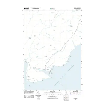
2011 Map of Cutler
USGS Topo · Published 2011About this map
Cutler sits at the head of a sheltered harbor on the Downeast coast, where the village's maritime character is defined by the Little River Island and its prominent Little River Lighthouse. The coastline is heavily indented with features like Fairy Head, Western Head, and Otter Point fronting the Grand Manan Channel. Inland, the landscape is a complex network of ridges and wetlands, including French Ridge and Pond Ridge, interspersed with meadows such as Warren Meadows and Crotched Meadow. For those tracing local history, the map identifies the Old Cutler Cemetery and Bay View Cemetery, providing key points of reference for the community's early residents near the smaller settlement of Little Machias.
Find a feature on this map
50 named features on this map. Tap any name to fly to it.
Don’t see what you’re looking for? This feature index may not catch every label — zoom into the map to look around manually.
Map Details
Editions of this 2011 Cutler Map
This is the sole edition of this map. No revisions or reprints were ever made.
Other maps of this area

1907 · Eastport
USGS Topo · 1:48,000

1908 · Eastport
USGS Topo · 1:62,500

1917 · Cutler
USGS Topo · 1:62,500

1918 · Machias
USGS Topo · 1:62,500

1918 · Cutler
USGS Topo · 1:62,500

1941 · Machias
USGS Topo · 1:62,500

1941 · Gardner Lake
USGS Topo · 1:62,500

1943 · Gardner Lake
USGS Topo · 1:62,500

1943 · Eastport
USGS Topo · 1:62,500

1945 · Eastport
USGS Topo · 1:62,500