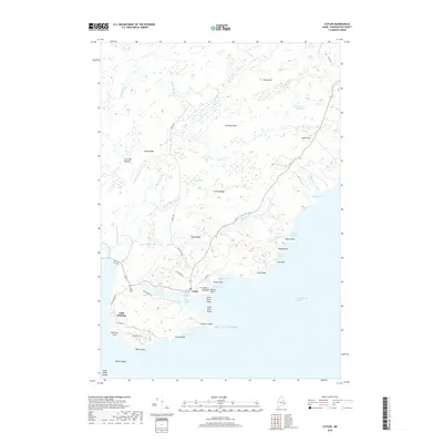
2018 Map of Cutler
USGS Topo · Published 2018About this map
Cutler Harbor serves as the focal point of this coastal Washington County landscape, where the village of Cutler overlooks the sheltered waters of Little River. The topography is defined by a series of northeast-trending ridges like French Ridge and Great Ridge, interspersed with extensive wetlands such as Crotched Meadow and Harmon Heath. This 2018 survey documents a remote shoreline characterized by dramatic coastal features, including Fairy Head and Western Head, which stand against the Grand Manan Channel. For genealogists, the map identifies local landmarks like Old Cutler Cem and Bay View Cem, providing specific locations for ancestral research. The inland areas are threaded with small waterways like Bother Brook and Schooner Brook, reflecting a landscape where the maritime economy of the Atlantic coast meets the interior forests and barrens of Down East Maine.
Find a feature on this map
59 named features on this map. Tap any name to fly to it.
Don’t see what you’re looking for? This feature index may not catch every label — zoom into the map to look around manually.
Map Details
Editions of this 2018 Cutler Map
This is the sole edition of this map. No revisions or reprints were ever made.
Other maps of this area

1907 · Eastport
USGS Topo · 1:48,000

1908 · Eastport
USGS Topo · 1:62,500

1917 · Cutler
USGS Topo · 1:62,500

1918 · Machias
USGS Topo · 1:62,500

1918 · Cutler
USGS Topo · 1:62,500

1941 · Machias
USGS Topo · 1:62,500

1941 · Gardner Lake
USGS Topo · 1:62,500

1943 · Gardner Lake
USGS Topo · 1:62,500

1943 · Eastport
USGS Topo · 1:62,500

1945 · Eastport
USGS Topo · 1:62,500