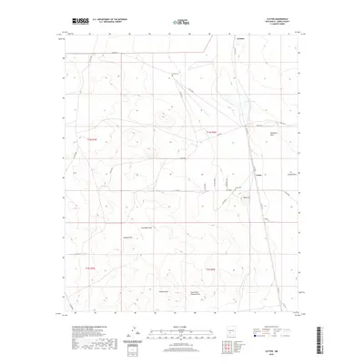
2020 Map of Cutter
USGS Topo · Published 2020About this map
Cutter and the northern reaches of the Jornada basin characterize this landscape in Sierra County, defined by a network of ephemeral drainage patterns and isolated burial grounds. The map detail highlights the ranching and rural infrastructure of the region, anchored by the Cutter Cem and Graham Cem. Topographical features such as Black Hill overlook a series of dry washes, including Hackberry Draw, Aleman Draw, and Putman Draw. These landforms, along with Jornada Lakes and the Number 7 Tank, reflect the essential water management required in this arid environment. A sparse but critical road network, including Upham Rd and Cutter Rd, connects the small settlements and homesteads across the Chihuahuan Desert terrain, providing a look at the enduring geographic layout of this part of southern New Mexico.
Find a feature on this map
35 named features on this map. Tap any name to fly to it.
Don’t see what you’re looking for? This feature index may not catch every label — zoom into the map to look around manually.
Map Details
Editions of this 2020 Cutter Map
This is the sole edition of this map. No revisions or reprints were ever made.
Other maps of this area

1916 · Tonuco
USGS Topo · 1:125,000

1916 · Salinas Peak
USGS Topo · 1:125,000

1932 · Tonuco
USGS Topo · 1:125,000

1948 · Sowell
USGS Topo · 1:62,500

1948 · Chicken Well
USGS Topo · 1:62,500

1954 · Tularosa
USGS Topo · 1:250,000

1955 · Las Cruces
USGS Topo · 1:250,000

1958 · Las Cruces
USGS Topo · 1:250,000

1958 · Tularosa
USGS Topo · 1:250,000

1958 · Elephant Butte
USGS Topo · 1:24,000