
1958 Map of Elephant Butte
USGS Topo · Published 1960About this map
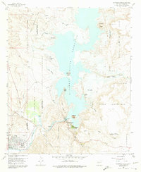
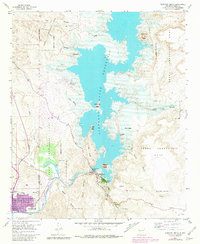
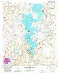
Elephant Butte Reservoir dominates this landscape, reflecting the mid-century hydrological development of the Rio Grande valley in Sierra County. The 1958 field check documents the area shortly after the town of Hot Springs famously renamed itself Truth or Consequences. To the south, the city is detailed with municipal landmarks including the St Anne Hospital, the Natl Guard Armory, and the Radio Tower (KCHS).
Find a feature on this map
37 named features on this map. Tap any name to fly to it.
Don’t see what you’re looking for? This feature index may not catch every label — zoom into the map to look around manually.
Map Details
Editions of this 1958 Elephant Butte Map
4 editions found
Other maps of this area

1954 · Tularosa
USGS Topo · 1:250,000

1958 · Tularosa
USGS Topo · 1:250,000

1959 · Engle
USGS Topo · 1:62,500

1961 · Huerfano Hill
USGS Topo · 1:24,000

1961 · Black Bluffs
USGS Topo · 1:24,000

1961 · Crocker
USGS Topo · 1:24,000

1961 · Williamsburg
USGS Topo · 1:24,000

1961 · Cuchillo
USGS Topo · 1:24,000

1979 · Truth or Consequences
USGS Topo · 1:100,000
1985 · Palomas Gap
USGS Topo · 1:24,000
Featured Places
- Truth or Consequences, NM
- Elephant Butte, NM
- Rock Canyon, NM
- Hot Springs Landing, NM
- Elephant Butte Estates, NM