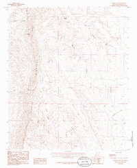
1985 Map of Palomas Gap
USGS Topo · Published 1985About this map
The Caballo Mountains dominate this 1980s landscape, providing a high-relief backdrop for a network of deep-cut drainage systems and springs in the high desert of Sierra County. The terrain is defined by dramatic geological features such as Turtle Mountain and Caballo Cone, while the Pedro Armendaris No 33 land grant boundary marks a significant portion of the northern quadrangle. Historically, the area shows evidence of mineral exploration with several Prospects noted near Lead Mine Canyon, reflecting the region's mining heritage.
Find a feature on this map
22 named features on this map. Tap any name to fly to it.
Don’t see what you’re looking for? This feature index may not catch every label — zoom into the map to look around manually.
Map Details
Editions of this 1985 Palomas Gap Map
This is the sole edition of this map. No revisions or reprints were ever made.
Other maps of this area

1954 · Tularosa
USGS Topo · 1:250,000

1955 · Las Cruces
USGS Topo · 1:250,000

1958 · Las Cruces
USGS Topo · 1:250,000

1958 · Tularosa
USGS Topo · 1:250,000

1958 · Elephant Butte
USGS Topo · 1:24,000

1959 · Engle
USGS Topo · 1:62,500

1959 · Upham
USGS Topo · 1:62,500

1961 · Caballo
USGS Topo · 1:24,000

1961 · Williamsburg
USGS Topo · 1:24,000

1961 · Cuchillo
USGS Topo · 1:24,000