
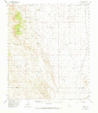
1959 Map of Upham
USGS Topo · Published 1964About this map
The Atchison Topeka and Santa Fe railroad corridor anchors the desert landscape of this 1959 survey, tracing a line through small rail-side settlements and ranching outposts. Communities such as Aleman, Upham, and Alivio dot the eastern plains, while the western reaches are defined by the rising elevation of Brushy Mountain and the Hogback Hills. This terrain is a network of water-scarce ranchlands, where cattle operations relied on numerous named water catchments like the Lyons Red Tank and family-named landmarks including the Lyons-Slater Ranch and Tipton Ranch. The infrastructure of the mid-20th century is evident in the presence of a Microwave Sta and Radio Relay Sta atop the high ground. Numerous windmills, such as the Gaume Windmill and Yoast Windmill, provide evidence of the vital groundwater extraction necessary for survival in this arid New Mexico environment.
Find a feature on this map
50 named features on this map. Tap any name to fly to it.
Don’t see what you’re looking for? This feature index may not catch every label — zoom into the map to look around manually.
Map Details
Editions of this 1959 Upham Map
2 editions found
Other maps of this area

1916 · Tonuco
USGS Topo · 1:125,000

1916 · Salinas Peak
USGS Topo · 1:125,000

1932 · Tonuco
USGS Topo · 1:125,000

1948 · Sowell
USGS Topo · 1:62,500

1948 · Chicken Well
USGS Topo · 1:62,500

1948 · San Diego Mountain
USGS Topo · 1:62,500

1954 · Tularosa
USGS Topo · 1:250,000

1955 · Las Cruces
USGS Topo · 1:250,000

1958 · Las Cruces
USGS Topo · 1:250,000

1958 · Tularosa
USGS Topo · 1:250,000