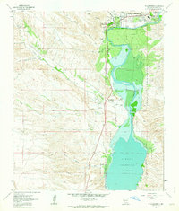
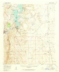
1961 Map of Williamsburg
USGS Topo · Published 1964About this map
Williamsburg and Truth or Consequences anchor the northern reaches of this Sierra County landscape, where the Rio Grande feeds the expansive Caballo Reservoir. The map illustrates a transition from the urban grid of these settlements to the agricultural and alluvial terrain of the valley. To the south, the village of Las Palomas sits at the confluence of Palomas Creek and the river, marking a point of long-standing local habitation. The western portion of the sheet is defined by an intricate network of drainage systems, including Arroyo King, North Kelly Canyon, and South Kelly Canyon, which carve through the high ground towards the reservoir. Details such as the Rodeo Ground near the river and the Reservation Boundary provide insight into the land use and administrative borders that shaped this region in the early 1960s.
Find a feature on this map
27 named features on this map. Tap any name to fly to it.
Don’t see what you’re looking for? This feature index may not catch every label — zoom into the map to look around manually.
Map Details
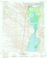
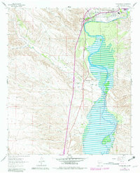
Editions of this 1961 Williamsburg Map
3 editions found
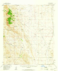
Other maps of this area

1954 · Tularosa
USGS Topo · 1:250,000

1955 · Las Cruces
USGS Topo · 1:250,000

1958 · Las Cruces
USGS Topo · 1:250,000

1958 · Tularosa
USGS Topo · 1:250,000
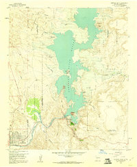
1958 · Elephant Butte
USGS Topo · 1:24,000
1959 · Engle
USGS Topo · 1:62,500
1959 · Upham
USGS Topo · 1:62,500

1961 · Skute Stone Arroyo
USGS Topo · 1:24,000
1961 · Saladone Tank
USGS Topo · 1:24,000
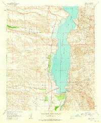
1961 · Caballo
USGS Topo · 1:24,000