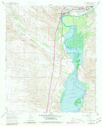
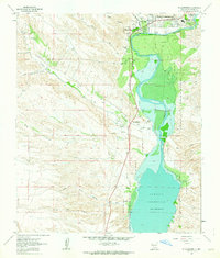
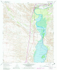
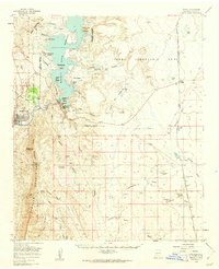
1961 Map of Williamsburg
USGS Topo · Published 1981About this map
Williamsburg and Truth or Consequences occupy the northern reach of this 1961 survey, where the desert landscape meets the engineered waters of the Rio Grande. This era reflects a critical period of water management and rural settlement along the river, visible in features like the Community Ditch and the vast expanse of the Caballo Reservoir stretching to the south. The proximity of Las Palomas and its Las Palomas Ch highlights the importance of historic riverfront communities before the full expansion of modern infrastructure.
Find a feature on this map
19 named features on this map. Tap any name to fly to it.
Don’t see what you’re looking for? This feature index may not catch every label — zoom into the map to look around manually.
Map Details
Editions of this 1961 Williamsburg Map
3 editions found
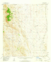
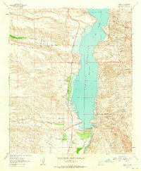
Other maps of this area

1954 · Tularosa
USGS Topo · 1:250,000

1955 · Las Cruces
USGS Topo · 1:250,000

1958 · Las Cruces
USGS Topo · 1:250,000

1958 · Tularosa
USGS Topo · 1:250,000
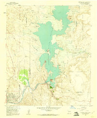
1958 · Elephant Butte
USGS Topo · 1:24,000
1959 · Engle
USGS Topo · 1:62,500
1959 · Upham
USGS Topo · 1:62,500

1961 · Skute Stone Arroyo
USGS Topo · 1:24,000
1961 · Saladone Tank
USGS Topo · 1:24,000
1961 · Caballo
USGS Topo · 1:24,000