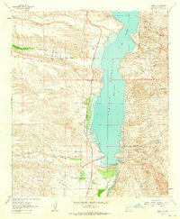
1961 Map of Caballo
USGS Topo · Published 1964About this map
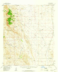
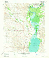
Caballo Reservoir dominates this 1961 landscape, where the waters of the Rio Grande are managed by the significant Caballo Dam and the Percha Diversion Dam. The settlement of Caballo serves as a focal point along the western shore, featuring a Po and Community Hall, while the smaller community of Oasis sits further south. The map documents a complex network of arroyos and canyons carving into the high ground, including Ash Canyon and Bat Cave Canyon. Evidence of past industry and movement is visible through Dredge Tailings near the river and established routes like Lees Trail and Jesp Trail. Numerous water sources, such as Las Animas Creek and Flowing Wells, highlight the critical role of water management in this arid Sierra County terrain.
Find a feature on this map
37 named features on this map. Tap any name to fly to it.
Don’t see what you’re looking for? This feature index may not catch every label — zoom into the map to look around manually.
Map Details
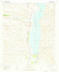
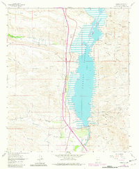
Editions of this 1961 Caballo Map
3 editions found
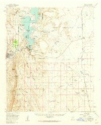
Other maps of this area

1954 · Tularosa
USGS Topo · 1:250,000

1955 · Las Cruces
USGS Topo · 1:250,000

1958 · Las Cruces
USGS Topo · 1:250,000

1958 · Tularosa
USGS Topo · 1:250,000
1959 · Engle
USGS Topo · 1:62,500
1959 · Upham
USGS Topo · 1:62,500

1961 · Skute Stone Arroyo
USGS Topo · 1:24,000
1961 · Saladone Tank
USGS Topo · 1:24,000
1961 · Clark Spring Canyon
USGS Topo · 1:24,000
1961 · Williamsburg
USGS Topo · 1:24,000