1961 Map of Caballo
USGS Topo · Published 1981About this map
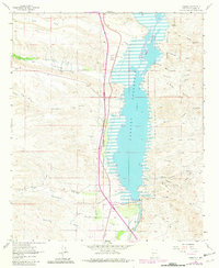
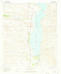
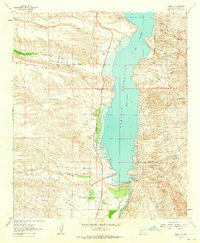
Caballo Reservoir dominates the landscape of this Sierra County survey, as it appeared in the early 1960s with revisions through 1980. The settlement of Caballo and nearby Oasis sit along the western shore, supported by the Percha Diversion Dam and an intricate network of irrigation features like the Bonita Ditch. The map reveals a transition from agricultural infrastructure to recreational and residential development, evidenced by the presence of a Trailer Park, Boat Docks, and the Community Hall.
Find a feature on this map
46 named features on this map. Tap any name to fly to it.
Don’t see what you’re looking for? This feature index may not catch every label — zoom into the map to look around manually.
Map Details
Editions of this 1961 Caballo Map
3 editions found
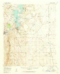
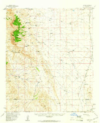
Other maps of this area

1954 · Tularosa
USGS Topo · 1:250,000

1955 · Las Cruces
USGS Topo · 1:250,000

1958 · Las Cruces
USGS Topo · 1:250,000

1958 · Tularosa
USGS Topo · 1:250,000
1959 · Engle
USGS Topo · 1:62,500
1959 · Upham
USGS Topo · 1:62,500

1961 · Skute Stone Arroyo
USGS Topo · 1:24,000
1961 · Saladone Tank
USGS Topo · 1:24,000
1961 · Caballo
USGS Topo · 1:24,000
1961 · Clark Spring Canyon
USGS Topo · 1:24,000