1961 Map of Caballo
USGS Topo · Published 1975About this map
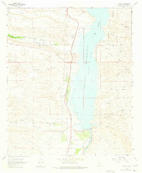
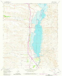
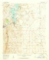
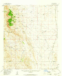
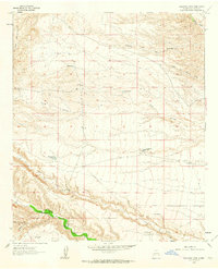
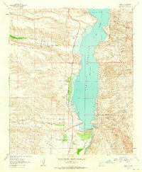
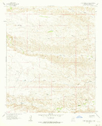
The Caballo Reservoir dominates this high-desert landscape, held back by the Caballo Dam on the Rio Grande. This early 1960s survey documents the complex water management system of the era, including the Percha Diversion Dam and the Bonita Community Ditch which provided essential irrigation to the valley below. Small desert settlements like Caballo and Oasis appear along the highway, supported by a network of flowing wells tapping into the subterranean flow of ephemeral drainages like Las Animas Creek and Percha Creek. Beyond the water's edge, the map reveals evidence of resource extraction and geological study, from dredge tailings along the river to remote mineral sites like Stop Mine. Rugged eastern topography is etched with numerous named canyons, such as Bat Cave Canyon and Apache Canyon, highlighting the sharp contrast between the managed river corridor and the arid wilderness of the reservation border.
Find a feature on this map
40 named features on this map. Tap any name to fly to it.
Don’t see what you’re looking for? This feature index may not catch every label — zoom into the map to look around manually.
Map Details
Editions of this 1961 Caballo Map
3 editions found
Other maps of this area

1954 · Tularosa
USGS Topo · 1:250,000

1955 · Las Cruces
USGS Topo · 1:250,000

1958 · Las Cruces
USGS Topo · 1:250,000

1958 · Tularosa
USGS Topo · 1:250,000
1959 · Engle
USGS Topo · 1:62,500
1959 · Upham
USGS Topo · 1:62,500

1961 · Skute Stone Arroyo
USGS Topo · 1:24,000
1961 · Saladone Tank
USGS Topo · 1:24,000
1961 · Caballo
USGS Topo · 1:24,000
1961 · Clark Spring Canyon
USGS Topo · 1:24,000