
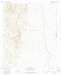
1961 Map of Crocker
USGS Topo · Published 1963About this map
The Fra Cristobal Range dominates the western half of this 1961 survey, rising sharply from the eastern plains. This arid landscape is marked by a series of dramatic openings through the mountain spine, including Red Gap, Chalk Gap, and the evocatively named Massacre Gap. These natural passes provided critical east-west transit points in a territory otherwise defined by its lack of surface water and steep relief. To the east, the terrain levels into the vast Jornada del Muerto, where the survival of ranching operations relied heavily on isolated water sources like Walnut Springs, Spellmeyer Well, and Burt Cook Well.
Find a feature on this map
21 named features on this map. Tap any name to fly to it.
Don’t see what you’re looking for? This feature index may not catch every label — zoom into the map to look around manually.
Map Details
Editions of this 1961 Crocker Map
2 editions found
Other maps of this area

1916 · Salinas Peak
USGS Topo · 1:125,000

1948 · Sowell
USGS Topo · 1:62,500

1948 · Malpais Well
USGS Topo · 1:62,500

1954 · Tularosa
USGS Topo · 1:250,000

1958 · Tularosa
USGS Topo · 1:250,000

1958 · Elephant Butte
USGS Topo · 1:24,000

1959 · Engle
USGS Topo · 1:62,500

1961 · Black Bluffs
USGS Topo · 1:24,000

1961 · Lava
USGS Topo · 1:24,000

1961 · Romero Canyon
USGS Topo · 1:24,000