1961 Map of Black Bluffs
USGS Topo · Published 1963About this map
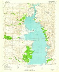
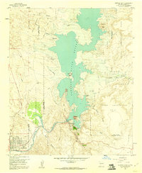
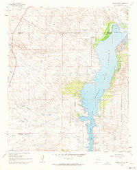
Elephant Butte Reservoir dominates this landscape, showing its 1961 water levels and the complex fingers of the submerged Rio Grande valley. The map documents a critical transition point where the Alamosa River enters the reservoir near Elkins Ranch and the small settlement of Monticello. This area is defined by its deep canyon systems, including Cedar Canyon and Pinosa Canyon, which carve through the high ground west of the water.
Find a feature on this map
43 named features on this map. Tap any name to fly to it.
Don’t see what you’re looking for? This feature index may not catch every label — zoom into the map to look around manually.
Map Details
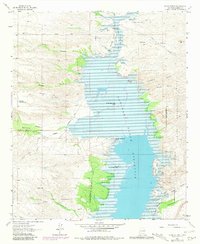
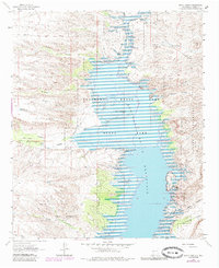
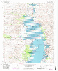
Editions of this 1961 Black Bluffs Map
4 editions found
Other maps of this area

1954 · Tularosa
USGS Topo · 1:250,000

1958 · Tularosa
USGS Topo · 1:250,000
1958 · Elephant Butte
USGS Topo · 1:24,000
1959 · Engle
USGS Topo · 1:62,500
1961 · Huerfano Hill
USGS Topo · 1:24,000
1961 · Sierra Fijardo
USGS Topo · 1:24,000
1961 · Crocker
USGS Topo · 1:24,000
1961 · Lava
USGS Topo · 1:24,000

1961 · Cuchillo
USGS Topo · 1:24,000
1961 · Romero Canyon
USGS Topo · 1:24,000