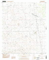
1996 Map of Cutter
USGS Topo · Published 2002About this map
Cutter stands as a focal point in this high-desert landscape of Sierra County, where the topography is defined by a series of prominent drainage systems. The terrain is marked by significant erosion patterns, including Jornada Draw, Hackberry Draw, and Putnam Draw, which channel seasonal water across the Pedro Armendaris No 33 land grant. Traces of human activity and industry are evident through the Old RR Grade and localized extraction sites such as Graves and a Gravel Pit. Low-lying Jornada Lakes and man-made features like a Check Dam and No 7 Tank illustrate the historical necessity of water management in this arid environment. Elevation shifts are anchored by landmarks like Black Hill, while local genealogy is represented by a small Cem located near the primary settlement.
Find a feature on this map
18 named features on this map. Tap any name to fly to it.
Don’t see what you’re looking for? This feature index may not catch every label — zoom into the map to look around manually.
Map Details
Editions of this 1996 Cutter Map
This is the sole edition of this map. No revisions or reprints were ever made.
Other maps of this area

1916 · Tonuco
USGS Topo · 1:125,000

1916 · Salinas Peak
USGS Topo · 1:125,000

1932 · Tonuco
USGS Topo · 1:125,000

1948 · Sowell
USGS Topo · 1:62,500

1948 · Chicken Well
USGS Topo · 1:62,500

1954 · Tularosa
USGS Topo · 1:250,000

1955 · Las Cruces
USGS Topo · 1:250,000

1958 · Las Cruces
USGS Topo · 1:250,000

1958 · Tularosa
USGS Topo · 1:250,000

1958 · Elephant Butte
USGS Topo · 1:24,000