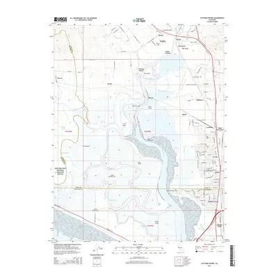
2015 Map of Cuttings Wharf
USGS Topo · Published 2015About this map
The Napa River dominates this landscape as it meanders toward San Pablo Bay, creating a complex network of wetlands and tidal channels. This environment is defined by its numerous named sloughs, including Steamboat Slough, Hudeman Slough, and China Slough, which weave around low-lying land masses like Bull Island and Russ Island. Much of the southwestern portion is protected within the San Pablo Bay National Wildlife Refuge, preserving the natural character of the marshes where the river meets the bay.
Find a feature on this map
124 named features on this map. Tap any name to fly to it.
Don’t see what you’re looking for? This feature index may not catch every label — zoom into the map to look around manually.
Map Details
Editions of this 2015 Cuttings Wharf Map
This is the sole edition of this map. No revisions or reprints were ever made.
Other maps of this area

1896 · Carquinez Strait
USGS Topo · 1:62,500

1898 · Karquines
USGS Topo · 1:62,500

1901 · Karquines
USGS Topo · 1:62,500

1902 · Napa
USGS Topo · 1:125,000

1916 · Mare Island
USGS Topo · 1:62,500

1921 · Mt. Vaca
USGS Topo · 1:62,500

1940 · Carquinez Strait
USGS Topo · 1:62,500

1942 · Mare Island
USGS Topo · 1:62,500

1942 · Carquinez
USGS Topo · 1:62,500

1942 · Sonoma
USGS Topo · 1:62,500