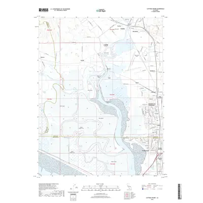
2018 Map of Cuttings Wharf
USGS Topo · Published 2018About this map
Napa River meanders through a complex network of sloughs and low-lying islands in this 2018 survey, defining the marshy transition between Napa and Solano Counties. The landscape is a study in diverse land use, where the industrial and residential growth of American Canyon and northern Vallejo meets the aqueous expanses of Knight Island and Russ Island. Near the top of the sheet, the Napa County Airport serves as a modern landmark adjacent to the small settlement at Cuttings Wharf.
Find a feature on this map
131 named features on this map. Tap any name to fly to it.
Don’t see what you’re looking for? This feature index may not catch every label — zoom into the map to look around manually.
Map Details
Editions of this 2018 Cuttings Wharf Map
This is the sole edition of this map. No revisions or reprints were ever made.
Other maps of this area

1896 · Carquinez Strait
USGS Topo · 1:62,500

1898 · Karquines
USGS Topo · 1:62,500

1901 · Karquines
USGS Topo · 1:62,500

1902 · Napa
USGS Topo · 1:125,000

1916 · Mare Island
USGS Topo · 1:62,500

1921 · Mt. Vaca
USGS Topo · 1:62,500

1940 · Carquinez Strait
USGS Topo · 1:62,500

1942 · Mare Island
USGS Topo · 1:62,500

1942 · Carquinez
USGS Topo · 1:62,500

1942 · Sonoma
USGS Topo · 1:62,500