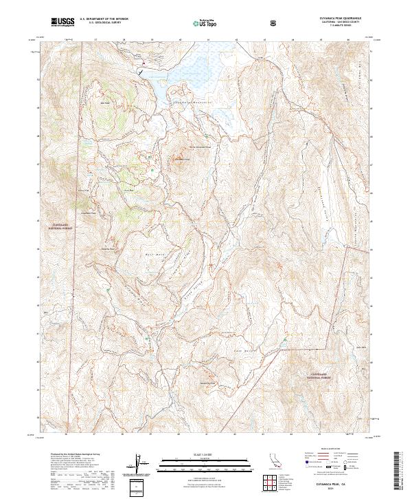
2021 Map of Cuyamaca Peak
USGS Topo · Published 2021About this map
The Cuyamaca Mountains dominate this high-elevation landscape within the Cleveland National Forest. Centered on the towering summits of Cuyamaca Peak and Stonewall Peak, the map reveals a complex network of ridgelines and secluded valleys used for both water management and recreation. The northern edge is anchored by Lake Cuyamaca, while the Sweetwater River and Japacha Cr carve drainage patterns through Green Valley. The terrain transitions from the deep cleft of Oriflamme Canyon in the northeast to the broad expanse of East Mesa. Numerous water sources, including Japacha Spring and Green Valley Falls, illustrate the critical hydrography of this San Diego County wilderness. A legacy of fire management and early transit is visible through dozens of named fire roads and historic paths like the Pacific Crest National Scenic Trl and the Kelly Ditch Trl.
Find a feature on this map
130 named features on this map. Tap any name to fly to it.
Don’t see what you’re looking for? This feature index may not catch every label — zoom into the map to look around manually.
Map Details
Editions of this 2021 Cuyamaca Peak Map
This is the sole edition of this map. No revisions or reprints were ever made.
Other maps of this area

1903 · Cuyamaca
USGS Topo · 1:125,000

1903 · Ramona
USGS Topo · 1:125,000

1904 · Southern California Sheet No. 2
USGS Topo · 1:250,000

1931 · Vallecito
USGS Topo · 1:125,000

1931 · Carrizo
USGS Topo · 1:125,000

1939 · Santa Ysabel
USGS Topo · 1:62,500

1939 · Borrego
USGS Topo · 1:62,500

1942 · Borego
USGS Topo · 1:62,500

1942 · Cuyapaipe
USGS Topo · 1:62,500

1942 · Cuyamaca Peak
USGS Topo · 1:62,500