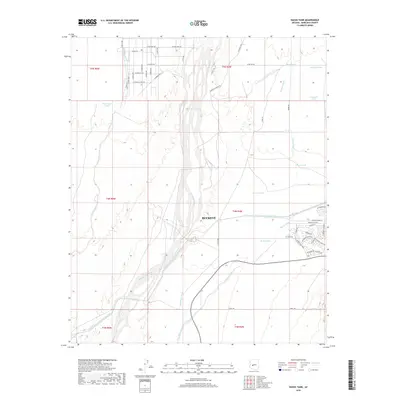
2018 Map of Daggs Tank
USGS Topo · Published 2018About this map
Buckeye and its surrounding desert landscape are defined by the critical movement of water through the arid terrain of Maricopa County. The Hassayampa River and its major tributaries, including Daggs Wash and Bootlegger Wash, pattern the land, punctuated by essential water storage points like New Daggs Tank, Roosevelt Tank, and Henrys Tank. These namesake "tanks" or cisterns reveal the historical and modern reliance on seasonal runoff in the Sonoran desert.
Find a feature on this map
54 named features on this map. Tap any name to fly to it.
Don’t see what you’re looking for? This feature index may not catch every label — zoom into the map to look around manually.
Map Details
Editions of this 2018 Daggs Tank Map
This is the sole edition of this map. No revisions or reprints were ever made.
Other maps of this area

1954 · Phoenix
USGS Topo · 1:250,000

1957 · Phoenix
USGS Topo · 1:250,000

1957 · White Tank Mts. SE
USGS Topo · 1:24,000

1957 · White Tank Mts. NE
USGS Topo · 1:24,000

1957 · White Tank Mts.
USGS Topo · 1:62,500

1958 · Phoenix
USGS Topo · 1:250,000

1960 · Phoenix
USGS Topo · 1:250,000

1961 · Vulture Mountains
USGS Topo · 1:62,500

1962 · Belmont Mts
USGS Topo · 1:62,500
1965 · Wittmann
USGS Topo · 1:24,000