
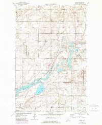
1946 Map of Dagmar
USGS Topo · Published 1976About this map
Dagmar serves as the focal point for this 1946 survey of northeastern Sheridan County, characterized by a structured network of section-line roads and scattered community institutions. The rural social fabric of the era is evident through the placement of localized education centers like Hiawatha Sch, Franklin Sch, Roosevelt Sch, and the uniquely named Hans Christian Andersen Sch. These schools, alongside Volmer Ch, provided vital gathering points for the farming families of this glaciated plains landscape.
Find a feature on this map
14 named features on this map. Tap any name to fly to it.
Don’t see what you’re looking for? This feature index may not catch every label — zoom into the map to look around manually.
Map Details
Editions of this 1946 Dagmar Map
2 editions found
Other maps of this area

1946 · Brush Lake
USGS Topo · 1:24,000

1947 · Capeneys Lake
USGS Topo · 1:24,000

1948 · Capeneys Lake
USGS Topo · 1:24,000

1948 · Dagmar
USGS Topo · 1:24,000

1948 · Brush Lake
USGS Topo · 1:24,000

1948 · Reserve SE
USGS Topo · 1:24,000

1948 · Sunnyhill School
USGS Topo · 1:24,000

1949 · Reserve SE
USGS Topo · 1:24,000

1949 · Sunnyhill School
USGS Topo · 1:24,000

1954 · Wolf Point
USGS Topo · 1:250,000