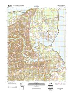
2013 Map of Dahlgren
USGS Topo · Published 2013About this map
The Potomac River shoreline defines this 2013 survey of King George County, where the infrastructure of the Dahlgren Naval Surface Warfare Center Airport sits adjacent to the sprawling waters of Upper Machodoc Cr. This maritime and military corridor is anchored by the Harry W Nice Memorial Bridge, which spans the river toward Maryland. The map reveals a transition from these high-traffic coastal facilities to the quieter, rural interior settlements of Dahlgren, Owens, and Ninde.
Find a feature on this map
106 named features on this map. Tap any name to fly to it.
Don’t see what you’re looking for? This feature index may not catch every label — zoom into the map to look around manually.
Map Details
Editions of this 2013 Dahlgren Map
This is the sole edition of this map. No revisions or reprints were ever made.
Other maps of this area

1889 · Fredericksburg
USGS Topo · 1:125,000

1892 · Fredericksburg
USGS Topo · 1:125,000

1892 · Montross
USGS Topo · 1:62,500

1894 · Wicomico
USGS Topo · 1:62,500

1894 · Fredericksburg
USGS Topo · 1:125,000

1895 · Wicomico
USGS Topo · 1:62,500

1895 · Nomini
USGS Topo · 1:125,000

1895 · Montross
USGS Topo · 1:62,500

1898 · Nomini
USGS Topo · 1:125,000

1902 · Wicomico
USGS Topo · 1:62,500