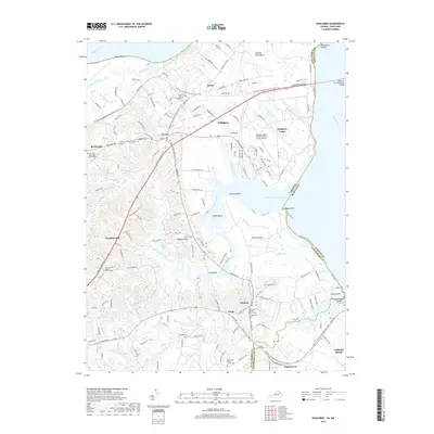
2019 Map of Dahlgren
USGS Topo · Published 2019About this map
The Potomac River dominates the northern and eastern margins of this survey, where the Harry W Nice Memorial Bridge connects Virginia and Maryland. Significant military and aviation history is centered at the Dahlgren Naval Surface Warfare Center Airport, surrounded by the communities of Dahlgren and Dahlgren Center. The landscape is defined by the winding reaches of Upper Machodoc Creek and Rosier Creek, which create distinctive peninsulas like Mathias Point Neck and Pumpkin Neck. Local heritage is deeply rooted in numerous country churches and cemeteries, including the Little Ark Baptist Church and the family-named Bumbrey Cem. Portions of the Potomac Heritage National Scenic Trail are visible, weaving through the rural stretches between Owens and Ninde, offering a look at the region's preservation of historic transit corridors.
Find a feature on this map
157 named features on this map. Tap any name to fly to it.
Don’t see what you’re looking for? This feature index may not catch every label — zoom into the map to look around manually.
Map Details
Editions of this 2019 Dahlgren Map
This is the sole edition of this map. No revisions or reprints were ever made.
Other maps of this area

1889 · Fredericksburg
USGS Topo · 1:125,000

1892 · Fredericksburg
USGS Topo · 1:125,000

1892 · Montross
USGS Topo · 1:62,500

1894 · Wicomico
USGS Topo · 1:62,500

1894 · Fredericksburg
USGS Topo · 1:125,000

1895 · Wicomico
USGS Topo · 1:62,500

1895 · Nomini
USGS Topo · 1:125,000

1895 · Montross
USGS Topo · 1:62,500

1898 · Nomini
USGS Topo · 1:125,000

1902 · Wicomico
USGS Topo · 1:62,500