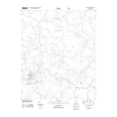
2011 Map of Dahlonega
USGS Topo · Published 2011About this map
Dahlonega serves as the center of this North Georgia survey, where the legacy of gold mining is etched into the landscape. The area surrounding Findley Ridge and Crown Mountain is densely packed with historical workings, including the Consolidated Mine, Findley Mine, and the Tahloneka Mine. These operations, along with numerous prospect cuts like the Capps Prospect and Ivy Cut, illustrate the intensive industrial effort that once defined this region. The Chestatee River and Yahoola Creek provide the primary drainage for the rugged terrain, which rises to heights at Three Sisters Mountain.
Find a feature on this map
105 named features on this map. Tap any name to fly to it.
Don’t see what you’re looking for? This feature index may not catch every label — zoom into the map to look around manually.
Map Details
Editions of this 2011 Dahlonega Map
This is the sole edition of this map. No revisions or reprints were ever made.
Other maps of this area

1886 · Dahlonega
USGS Topo · 1:125,000

1888 · Ellijay
USGS Topo · 1:125,000

1890 · Suwanee
USGS Topo · 1:125,000

1891 · Gainesville
USGS Topo · 1:125,000

1892 · Dahlonega
USGS Topo · 1:125,000

1892 · Ellijay
USGS Topo · 1:125,000

1894 · Suwanee
USGS Topo · 1:125,000

1896 · Dahlonega
USGS Topo · 1:125,000

1898 · Ellijay
USGS Topo · 1:125,000

1903 · Dahlonega
USGS Topo · 1:125,000