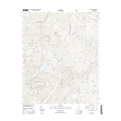
2014 Map of Dahlonega
USGS Topo · Published 2014About this map
Dahlonega serves as the focal point of this North Georgia mountain landscape, situated at the base of significant elevations like Crown Mtn and Findley Ridge. The settlement patterns recorded here reflect the region's complex topography, with winding routes such as Syrup Mill Rd and Old Mill Rd tracing the narrow valleys. Much of the northern portion is occupied by the Chattahoochee National Forest, where landmarks like Three Sisters Mtn overlook a network of waterways including Yahoola Creek and the Chestatee River. Local history is preserved through features like Mt Hope Cem and the crossing at Beardons Bridge. To the southeast, the smaller community of Garland sits near Burgess Lake, illustrating the more dispersed residential development of Lumpkin County during the early 21st century.
Find a feature on this map
170 named features on this map. Tap any name to fly to it.
Don’t see what you’re looking for? This feature index may not catch every label — zoom into the map to look around manually.
Map Details
Editions of this 2014 Dahlonega Map
This is the sole edition of this map. No revisions or reprints were ever made.
Other maps of this area

1886 · Dahlonega
USGS Topo · 1:125,000

1888 · Ellijay
USGS Topo · 1:125,000

1890 · Suwanee
USGS Topo · 1:125,000

1891 · Gainesville
USGS Topo · 1:125,000

1892 · Dahlonega
USGS Topo · 1:125,000

1892 · Ellijay
USGS Topo · 1:125,000

1894 · Suwanee
USGS Topo · 1:125,000

1896 · Dahlonega
USGS Topo · 1:125,000

1898 · Ellijay
USGS Topo · 1:125,000

1903 · Dahlonega
USGS Topo · 1:125,000