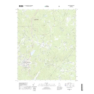
2020 Map of Dahlonega
USGS Topo · Published 2020About this map
Dahlonega serves as the focal point of this 2020 landscape, where the historic Lumpkin County Courthouse stands near the center of a modernizing Appalachian community. The University of North Georgia Dahlonega Campus occupies a significant portion of the city's west side, while the nearby Mount Hope Cem provides a point of genealogical interest. The surrounding terrain is defined by prominent elevations such as Three Sisters Mtn, Findley Ridge, and Crown Mtn, illustrating the high-relief topography of the Chattahoochee National Forest.
Find a feature on this map
172 named features on this map. Tap any name to fly to it.
Don’t see what you’re looking for? This feature index may not catch every label — zoom into the map to look around manually.
Map Details
Editions of this 2020 Dahlonega Map
This is the sole edition of this map. No revisions or reprints were ever made.
Other maps of this area

1886 · Dahlonega
USGS Topo · 1:125,000

1888 · Ellijay
USGS Topo · 1:125,000

1890 · Suwanee
USGS Topo · 1:125,000

1891 · Gainesville
USGS Topo · 1:125,000

1892 · Dahlonega
USGS Topo · 1:125,000

1892 · Ellijay
USGS Topo · 1:125,000

1894 · Suwanee
USGS Topo · 1:125,000

1896 · Dahlonega
USGS Topo · 1:125,000

1898 · Ellijay
USGS Topo · 1:125,000

1903 · Dahlonega
USGS Topo · 1:125,000