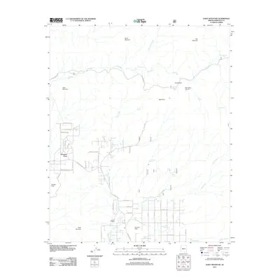
2011 Map of Daisy Mountain
USGS Topo · Published 2011About this map
Daisy Mountain and the surrounding high desert terrain define this landscape as it appeared in the early 21st century. The map shows a transition from rugged summits like Gavilan Peak and Pyramid Peak to the developing residential street networks north of the Phoenix valley. Water sources are vital markers in this arid environment, with New River, Skunk Creek, and several named springs such as Shoemaker Spring and Soda Springs distributed across the quadrangle. Local settlement and history are represented by sites including Wranglers Roost, Tee Ranch, and Shangri La Ranch. The road network is a mix of established thoroughfares like W New River Rd and rugged access routes such as Table Mesa Rd, reflecting the area's mix of suburban growth and open desert ranching.
Find a feature on this map
57 named features on this map. Tap any name to fly to it.
Don’t see what you’re looking for? This feature index may not catch every label — zoom into the map to look around manually.
Map Details
Editions of this 2011 Daisy Mountain Map
This is the sole edition of this map. No revisions or reprints were ever made.
Other maps of this area

1887 · Verde
USGS Topo · 1:250,000

1887 · Prescott
USGS Topo · 1:250,000

1892 · Verde
USGS Topo · 1:250,000

1892 · Prescott
USGS Topo · 1:250,000

1903 · Bradshaw Mountains
USGS Topo · 1:125,000

1929 · Turret Peak
USGS Topo · 1:125,000

1930 · Cave Creek
USGS Topo · 1:125,000

1933 · Turret Peak
USGS Topo · 1:125,000

1939 · Cave Creek
USGS Topo · 1:125,000

1947 · Bumblebee
USGS Topo · 1:62,500