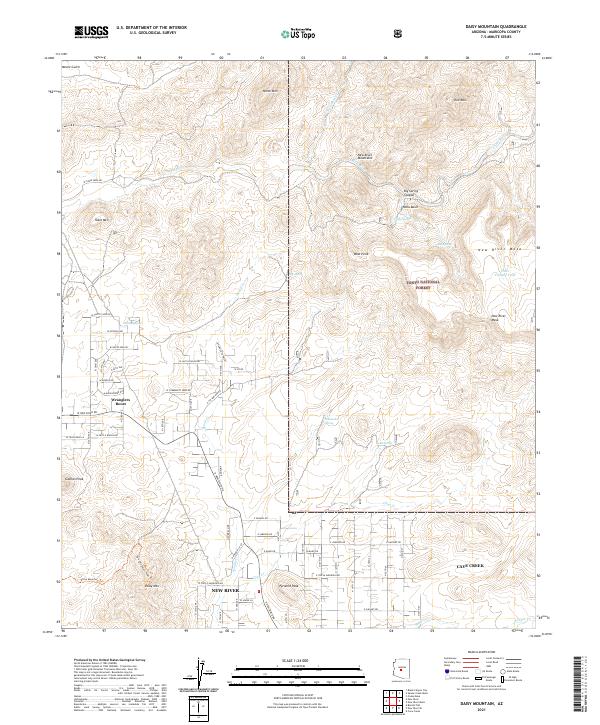
2021 Map of Daisy Mountain
USGS Topo · Published 2021About this map
New River and Cave Creek define the southern landscape of this 2021 survey, where residential development meets the high desert mountains. This map documents a contemporary network of local roads including W Circle Mountain Rd and W New River Rd, showing the expansion of these communities into the foothills. To the north and east, the terrain becomes increasingly complex as it rises into the Tonto National Forest, anchored by the prominent elevations of Daisy Mtn and Gavilan Peak.
Find a feature on this map
93 named features on this map. Tap any name to fly to it.
Don’t see what you’re looking for? This feature index may not catch every label — zoom into the map to look around manually.
Map Details
Editions of this 2021 Daisy Mountain Map
This is the sole edition of this map. No revisions or reprints were ever made.
Other maps of this area

1887 · Verde
USGS Topo · 1:250,000

1887 · Prescott
USGS Topo · 1:250,000

1892 · Verde
USGS Topo · 1:250,000

1892 · Prescott
USGS Topo · 1:250,000

1903 · Bradshaw Mountains
USGS Topo · 1:125,000

1929 · Turret Peak
USGS Topo · 1:125,000

1930 · Cave Creek
USGS Topo · 1:125,000

1933 · Turret Peak
USGS Topo · 1:125,000

1939 · Cave Creek
USGS Topo · 1:125,000

1947 · Bumblebee
USGS Topo · 1:62,500