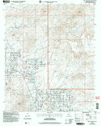
2004 Map of Daisy Mountain
USGS Topo · Published 2006About this map
Daisy Mountain and the surrounding high desert of Maricopa County are documented here during a period of modern expansion at the forest edge. The map highlights a landscape defined by its transition from the steep terrain of the Tonto National Forest and North Mountain to the burgeoning residential developments appearing south of Table Mountain. This intersection of wilderness and growth is marked by several water sources critical to the arid region, including Soda Springs, Corral Springs, and Shoemaker Spr.
Find a feature on this map
48 named features on this map. Tap any name to fly to it.
Don’t see what you’re looking for? This feature index may not catch every label — zoom into the map to look around manually.
Map Details
Editions of this 2004 Daisy Mountain Map
This is the sole edition of this map. No revisions or reprints were ever made.
Other maps of this area

1887 · Verde
USGS Topo · 1:250,000

1887 · Prescott
USGS Topo · 1:250,000

1892 · Verde
USGS Topo · 1:250,000

1892 · Prescott
USGS Topo · 1:250,000

1903 · Bradshaw Mountains
USGS Topo · 1:125,000

1929 · Turret Peak
USGS Topo · 1:125,000

1930 · Cave Creek
USGS Topo · 1:125,000

1933 · Turret Peak
USGS Topo · 1:125,000

1939 · Cave Creek
USGS Topo · 1:125,000

1947 · Bumblebee
USGS Topo · 1:62,500