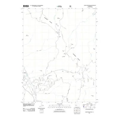
2011 Map of Dakan Mountain
USGS Topo · Published 2011About this map
Mining operations and resource extraction define the landscape along the Rampart Range in this 2011 survey. The terrain is marked by a dense concentration of named shafts and prospects, including the Watson Park Mine, Little Anna Mine, and the Denver Pegmatite Mine. The presence of several pegmatite operations, such as the Baldwin Pegmatite Mine, points to the specific mineral geology of this section of Colorado.
Find a feature on this map
43 named features on this map. Tap any name to fly to it.
Don’t see what you’re looking for? This feature index may not catch every label — zoom into the map to look around manually.
Map Details
Editions of this 2011 Dakan Mountain Map
This is the sole edition of this map. No revisions or reprints were ever made.
Other maps of this area

1893 · Platte Canyon
USGS Topo · 1:125,000

1894 · Castle Rock
USGS Topo · 1:125,000

1913 · Castle Rock
USGS Topo · 1:125,000

1940 · Castle Rock
USGS Topo · 1:62,500

1945 · Castle Rock
USGS Topo · 1:62,500

1953 · Denver
USGS Topo · 1:250,000

1954 · Devils Head
USGS Topo · 1:24,000

1954 · Deckers
USGS Topo · 1:24,000

1954 · Mount Deception
USGS Topo · 1:24,000
1954 · Palmer Lake
USGS Topo · 1:24,000