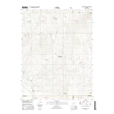
2016 Map of Dakan Mountain
USGS Topo · Published 2016About this map
Pike National Forest encompasses much of this landscape along the Rampart Range, where the boundary lines of Douglas, Teller, and El Paso counties converge. The terrain is defined by prominent elevations such as Dakan Mtn and Storm Peak, while narrow drainages like White Spruce Gulch and Polhemus Gulch cut through the high country. Small pockets of residential development appear at Perry Park in the northeast and Rainbow Falls Park in the west, contrasting with the expansive wildlands.
Find a feature on this map
44 named features on this map. Tap any name to fly to it.
Don’t see what you’re looking for? This feature index may not catch every label — zoom into the map to look around manually.
Map Details
Editions of this 2016 Dakan Mountain Map
This is the sole edition of this map. No revisions or reprints were ever made.
Other maps of this area

1893 · Platte Canyon
USGS Topo · 1:125,000

1894 · Castle Rock
USGS Topo · 1:125,000

1913 · Castle Rock
USGS Topo · 1:125,000

1940 · Castle Rock
USGS Topo · 1:62,500

1945 · Castle Rock
USGS Topo · 1:62,500

1953 · Denver
USGS Topo · 1:250,000

1954 · Devils Head
USGS Topo · 1:24,000

1954 · Deckers
USGS Topo · 1:24,000

1954 · Mount Deception
USGS Topo · 1:24,000
1954 · Palmer Lake
USGS Topo · 1:24,000