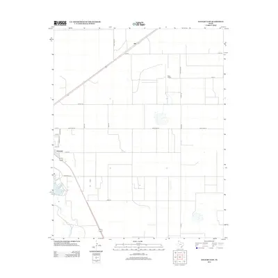
2012 Map of Dalhart East
USGS Topo · Published 2012About this map
Dalhart serves as the primary urban center for this High Plains landscape, where the town's eastern grid meets a sprawling network of ranch and county roads. The terrain is defined by the drainage of Rita Blanca Cr, which feeds into the prominent Rita Blanca Lake at the southwestern edge of the quadrangle. This 2012 survey illustrates the intersection of regional infrastructure and private land use, characterized by long, straight thoroughfares like Noble Rd and Hesse Rd that partition the landscape into large agricultural blocks. Near the small settlement of Hitt in the north, the corridor for FM-695 and Andy James Rd provides a sense of the area's transportation connectivity. Aviation history is noted by the presence of Miller Airfield, positioned amidst the various ranch roads that lace through the cattle country of the Texas Panhandle.
Find a feature on this map
24 named features on this map. Tap any name to fly to it.
Don’t see what you’re looking for? This feature index may not catch every label — zoom into the map to look around manually.
Map Details
Editions of this 2012 Dalhart East Map
This is the sole edition of this map. No revisions or reprints were ever made.
Other maps of this area

1954 · Tucumcari
USGS Topo · 1:250,000

1954 · Dalhart
USGS Topo · 1:250,000

1958 · Tucumcari
USGS Topo · 1:250,000

1958 · Dalhart
USGS Topo · 1:250,000

1962 · Dalhart
USGS Topo · 1:250,000

1963 · Hartley NE
USGS Topo · 1:24,000

1965 · Wilco
USGS Topo · 1:24,000

1965 · Wilco NE
USGS Topo · 1:24,000

1973 · Pardue Camp
USGS Topo · 1:24,000

1973 · Hartley
USGS Topo · 1:24,000