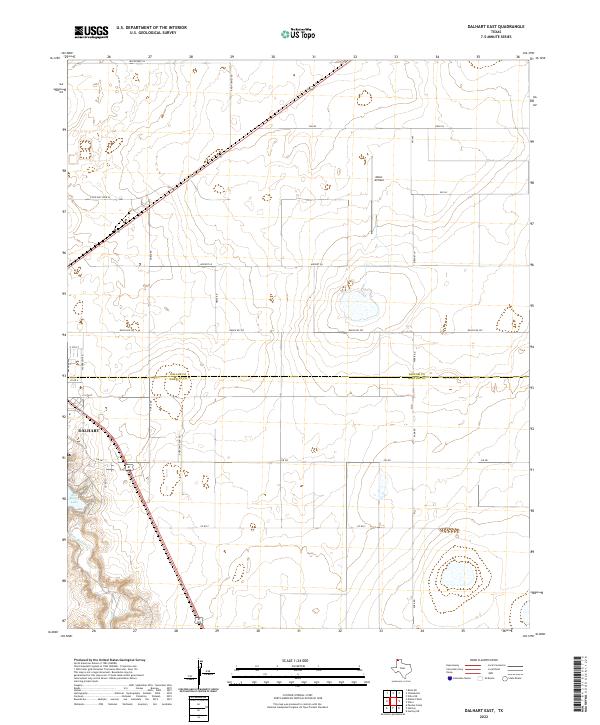
2022 Map of Dalhart East
USGS Topo · Published 2022About this map
The high plains of the Texas Panhandle meet the urban edge of Dalhart in this survey of the borderlands between Dallam and Hartley counties. The landscape is defined by the sharp transition from the city's residential grid—anchored by E 16th St and Sagebrush Rd—to a vast network of section roads and rural homesteads. To the south and west, the terrain drops toward the waters of Rita Blanca Lake, fed by the winding course of Rita Blanca Cr. This area represents the essential character of the High Plains, where the infrastructure of agriculture and aviation, such as Miller Airfield, sits alongside significant natural drainage systems. The survey details the convergence of state and local routes, including FM 281 and State Hwy Spur 24, which connect the outlying ranch lands to the heart of the community.
Find a feature on this map
27 named features on this map. Tap any name to fly to it.
Don’t see what you’re looking for? This feature index may not catch every label — zoom into the map to look around manually.
Map Details
Editions of this 2022 Dalhart East Map
This is the sole edition of this map. No revisions or reprints were ever made.
Other maps of this area

1954 · Tucumcari
USGS Topo · 1:250,000

1954 · Dalhart
USGS Topo · 1:250,000

1958 · Tucumcari
USGS Topo · 1:250,000

1958 · Dalhart
USGS Topo · 1:250,000

1962 · Dalhart
USGS Topo · 1:250,000

1963 · Hartley NE
USGS Topo · 1:24,000

1965 · Wilco
USGS Topo · 1:24,000

1965 · Wilco NE
USGS Topo · 1:24,000

1973 · Pardue Camp
USGS Topo · 1:24,000

1973 · Hartley
USGS Topo · 1:24,000