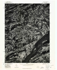
1977 Map of Dalmatia
USGS Topo · Published 1979About this map
Dalmatia and the surrounding farmland sit perched above the east bank of the Susquehanna River in this late-1970s orthophotograph. The imagery reveals the intricate, winding contours of Pennsylvania's ridge and valley province, where strip-farming patterns follow the natural flow of the terrain. The small settlements of Verdilla and Meiservill appear as concentrated clusters of buildings within a landscape dominated by agricultural production. The convergence of the North Branch and West Branch streams, along with the Mahantango Creek, illustrates the drainage network that carved these hills. This specific aerial perspective, produced in cooperation with the Soil Conservation Service, provides an unfiltered look at the rural land-use practices and road networks connecting Independence to the riverside before modern development altered the mid-century agrarian footprint.
Find a feature on this map
8 named features on this map. Tap any name to fly to it.
Don’t see what you’re looking for? This feature index may not catch every label — zoom into the map to look around manually.
Map Details
Editions of this 1977 Dalmatia Map
This is the sole edition of this map. No revisions or reprints were ever made.
Other maps of this area

1893 · Sunbury
USGS Topo · 1:62,500

1893 · Millersburg
USGS Topo · 1:62,500

1907 · Millerstown
USGS Topo · 1:62,500

1938 · Mifflinburg
USGS Topo · 1:48,000

1943 · Millerstown
USGS Topo · 1:62,500

1943 · Millersburg
USGS Topo · 1:62,500

1943 · Sunbury
USGS Topo · 1:62,500

1943 · Mifflinburg
USGS Topo · 1:62,500
1947 · Elizabethville
USGS Topo · 1:24,000
1947 · Millersburg
USGS Topo · 1:24,000
Featured Places
- Chapman, PA
- Chapman Township, PA
- Port Trevorton, PA
- Lower Mahanoy Township, PA
- Upper Paxton Township, PA