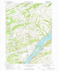
1969 Map of Dalmatia
USGS Topo · Published 1977About this map
The Susquehanna River dominates this 1969 landscape, flowing past the riverside community of Dalmatia and through a series of significant river islands including Herrold Island, Browns Island, and Zeigler Island. Along the eastern bank, the Penn Central railroad tracks follow the water's edge, tracing the industrial and transit corridor below Lower Mahanoy Ridge. To the west, the terrain rises into the ridge-and-valley province, where smaller settlements like Meiserville and McKees Half Falls sit near the confluence of several branches of Mahantango Creek. This area preserves numerous traditional landmarks, most notably a Covered Bridge on the North Branch Mahantango Creek and a network of rural meeting houses such as Grubbs Ch, Bethel Ch, and the Paradise Ch in Chapman.
Find a feature on this map
64 named features on this map. Tap any name to fly to it.
Don’t see what you’re looking for? This feature index may not catch every label — zoom into the map to look around manually.
Map Details
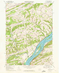
Editions of this 1969 Dalmatia Map
2 editions found
Other maps of this area

1893 · Sunbury
USGS Topo · 1:62,500

1893 · Millersburg
USGS Topo · 1:62,500

1907 · Millerstown
USGS Topo · 1:62,500

1938 · Mifflinburg
USGS Topo · 1:48,000

1943 · Millerstown
USGS Topo · 1:62,500

1943 · Millersburg
USGS Topo · 1:62,500

1943 · Sunbury
USGS Topo · 1:62,500

1943 · Mifflinburg
USGS Topo · 1:62,500
1947 · Elizabethville
USGS Topo · 1:24,000
1947 · Millersburg
USGS Topo · 1:24,000
Featured Places
- Chapman, PA
- Chapman Township, PA
- Port Trevorton, PA
- Lower Mahanoy Township, PA
- Upper Paxton Township, PA