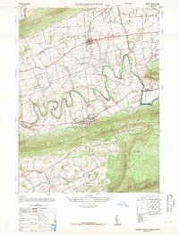
1947 Map of Elizabethville
USGS Topo · Published 1947About this map
Elizabethville serves as the central hub of this 1947 survey, situated in the valley between the prominent ridges of Berry Mountain and Mahantango Mountain. The landscape is defined by the winding course of Wiconisco Creek, which meanders eastward past Oakdale Station toward Loyalton. This era shows a well-developed network of small rural schools and parish churches that anchored the farming communities of Upper Dauphin County, such as the Schoffstall School and St Johns Church.
Find a feature on this map
37 named features on this map. Tap any name to fly to it.
Don’t see what you’re looking for? This feature index may not catch every label — zoom into the map to look around manually.
Map Details
Editions of this 1947 Elizabethville Map
2 editions found
Other maps of this area

1892 · Lykens
USGS Topo · 1:62,500

1892 · Hummelstown
USGS Topo · 1:62,500

1892 · Harrisburg
USGS Topo · 1:62,500

1893 · Lykens
USGS Topo · 1:62,500

1893 · Millersburg
USGS Topo · 1:62,500

1899 · Harrisburg
USGS Topo · 1:62,500

1924 · Hummelstown
USGS Topo · 1:62,500

1924 · Harrisburg
USGS Topo · 1:62,500

1943 · Millersburg
USGS Topo · 1:62,500

1943 · Lykens
USGS Topo · 1:62,500
Featured Places
- Elizabethville, PA
- Wiconisco Township, PA
- Berrysburg, Mifflin Township
- Jackson Township, PA
- Jefferson Township, PA