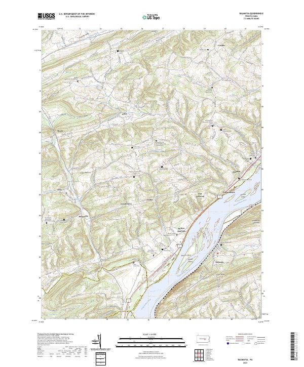
2023 Map of Dalmatia
USGS Topo · Published 2023About this map
The Susquehanna River defines this landscape as it flows between Snyder Co, Juniata Co, and Northumberland Co, dividing the western ridges from the heights of Hooflander Mountain. This modern survey illustrates the persistent rural character of the region, where numerous small settlements like Port Trevorton, Meiserville, and McKees Half Falls sit along the river's western bank.
Find a feature on this map
78 named features on this map. Tap any name to fly to it.
Don’t see what you’re looking for? This feature index may not catch every label — zoom into the map to look around manually.
Map Details
Editions of this 2023 Dalmatia Map
This is the sole edition of this map. No revisions or reprints were ever made.
Other maps of this area

1893 · Sunbury
USGS Topo · 1:62,500

1893 · Millersburg
USGS Topo · 1:62,500

1907 · Millerstown
USGS Topo · 1:62,500

1938 · Mifflinburg
USGS Topo · 1:48,000

1943 · Millerstown
USGS Topo · 1:62,500

1943 · Millersburg
USGS Topo · 1:62,500

1943 · Sunbury
USGS Topo · 1:62,500

1943 · Mifflinburg
USGS Topo · 1:62,500
1947 · Elizabethville
USGS Topo · 1:24,000
1947 · Millersburg
USGS Topo · 1:24,000
Featured Places
- Chapman, PA
- Lower Mahanoy Township, PA
- Liverpool Township, PA
- Perry Township, PA
- Upper Paxton Township, PA