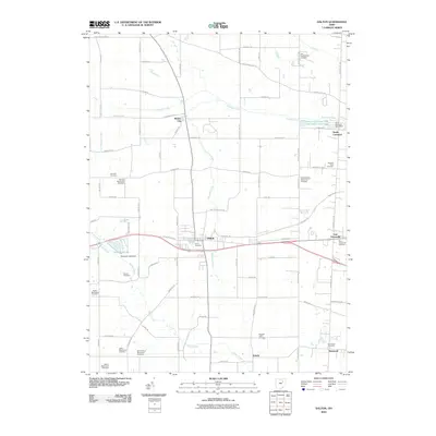
2010 Map of Dalton
USGS Topo · Published 2010About this map
Sonnenberg Mennonite Cemetery and Kidron Mennonite Cemetery anchor the southwestern reaches of this Stark County landscape, highlighting a region deeply rooted in Mennonite heritage. This 2010 survey details the village of Dalton at the intersection of Old Lincoln Way and Route 94, where the Ohio-Erie Trl follows the path of former transportation corridors. The topography is defined by the drainage of Sugar Creek and Newman Creek, with numerous family and community burial grounds like Van Kirk Cemetery and Pleasant Valley Cemetery scattered across the rural sections. The map reveals the layout of small settlements such as North Lawrence, featuring the North Lawrence Post Office and the North Lawrence Fish and Game Club Lake, and East Greenville to the east, providing a detailed record of local roads and water management features like Beaverdam Ditch.
Find a feature on this map
86 named features on this map. Tap any name to fly to it.
Don’t see what you’re looking for? This feature index may not catch every label — zoom into the map to look around manually.
Map Details
Editions of this 2010 Dalton Map
This is the sole edition of this map. No revisions or reprints were ever made.
Other maps of this area

1901 · Massillon
USGS Topo · 1:62,500

1901 · Wooster
USGS Topo · 1:62,500

1903 · Massillon
USGS Topo · 1:62,500

1903 · Wooster
USGS Topo · 1:62,500

1914 · Navarre
USGS Topo · 1:62,500

1915 · Millersburg
USGS Topo · 1:62,500

1943 · Millersburg
USGS Topo · 1:62,500

1944 · Navarre
USGS Topo · 1:62,500

1951 · Canton
USGS Topo · 1:250,000

1953 · Canton
USGS Topo · 1:250,000