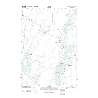
2011 Map of Damariscotta
USGS Topo · Published 2011About this map
The Sheepscot River and Damariscotta River define the hydraulic character of this mid-coast Maine landscape, where tidal marshes and narrow river valleys dictated the placement of historic settlements. Damariscotta Mills stands out at the southern tip of Damariscotta Lake, where the Damariscotta Lake Dam regulates the transition from freshwater to the tidal basin. Further west, the villages of Head Tide and Alna follow the winding course of the Sheepscot River, while Sheepscot sits near the confluence with the Dyer River. The distribution of burial grounds, such as Alna Cemetery and Glidden Cemetery, reflects the long-established family homesteads and local parishes that have inhabited these banks for centuries. This map documents a complex coastal network of small points and islands, including Glidden Point and Woodbridge Island, which highlight the intricate relationship between the region's landforms and its maritime-influenced economy.
Find a feature on this map
124 named features on this map. Tap any name to fly to it.
Don’t see what you’re looking for? This feature index may not catch every label — zoom into the map to look around manually.
Map Details
Editions of this 2011 Damariscotta Map
This is the sole edition of this map. No revisions or reprints were ever made.
Other maps of this area

1893 · Wiscasset
USGS Topo · 1:62,500

1893 · Boothbay
USGS Topo · 1:62,500

1904 · Monhegan
USGS Topo · 1:62,500

1906 · Monhegan
USGS Topo · 1:62,500

1913 · Waldoboro
USGS Topo · 1:48,000

1915 · Waldoboro
USGS Topo · 1:62,500

1941 · Waldoboro
USGS Topo · 1:62,500

1941 · Boothbay
USGS Topo · 1:62,500

1943 · Boothbay
USGS Topo · 1:62,500

1944 · Wiscasset
USGS Topo · 1:62,500